

Contents 30
Overview
The Ring Road, or Route 1, loops around Iceland for 1,309 fully paved kilometres, meaning 16 to 20 hours of pure driving that 10 days spread out comfortably.
Route 1 circles Iceland completely and reaches almost everything people come here for: waterfalls, glaciers, black beaches, geothermal fields and fishing villages. It runs 1,309 km, though a 10-day loop like the one described here covers closer to 1,820 once you add the detours to the Golden Circle, Snæfellsnes and Seyðisfjörður. The circle was only completed in 1974, when the bridge over the Skeiðará river went up in the south-east.
The whole loop is paved today, but it still has 31 single-lane bridges. The landscape changes every fifty kilometres, from bare lava plateau to the carved fjords of the east.
Ten days is the format that lets the itinerary breathe. At 2 to 4 hours of daily driving, you still have time to walk, swim and wait for the light. Under a week, the trip turns into one long chain of transfers.
- Capital: Reykjavík
- Currency: Icelandic króna (ISK), 1 EUR = 141.80 ISK as of 05/08/2026
- Official language: Icelandic, with English spoken everywhere
- Status: outside the European Union, but in the EEA since 1994 and in the Schengen Area
- Main airport: Keflavík (KEF), 50 km from Reykjavík
12 places to take with you
In the guide's order, ready for Google Maps or your GPS.
Book the activities from this guide
Our picks for Iceland, well rated and free to cancel.
-
Book this activity
Hunting the northern lights
Free on your own, EUR 60-90 per person on a guided tour
-
Book this activity
Glacier hike or ice cave
From 8,490 ISK (~EUR 60) for an intro walk, EUR 150-200 for hike + ice cave
-
Book this activity
Geothermal bath
From EUR 8 (municipal pool, ~1,200 ISK) to EUR 85 (Blue Lagoon Comfort, ~11,990 ISK)
Affiliate links: Travel Advice earns a commission if you book, at no extra cost to you. Learn more

Jökulsárlón
Blocks of blue-tinged ice drift slowly towards the sea in a silence broken only by the cracking of the glacier. Light passes through the icebergs and makes them look almost unreal.
This is the deepest lake in Iceland, at 284 m. The icebergs calve off Breiðamerkurjökull, a tongue of Vatnajökull, and the lagoon's surface has quadrupled since the 1970s as the glacier retreats.
You can walk the shore, take a zodiac or an amphibious boat, and cross the road to Diamond Beach, where stranded blocks glitter on the black sand. Allow 2 hours to do both sides properly.
No other Icelandic site brings together glacier, lagoon and beach in a single stop. It is the high point of the south-east coast, and the only place where you touch Vatnajökull without leaving Route 1.
The classic mistake is to stop only at the lagoon and drive off. Diamond Beach is on the other side of the bridge, five minutes away, and it is often the better of the two. Cross the road at the marked crossing, never diagonally.
Aim for early morning or after 6 pm: buses from Reykjavík saturate the site between 11 am and 4 pm. Book the boat trip the day before in summer.

Þingvellir
You walk down a sunken path between two basalt walls, and you are literally walking in the rift that separates two continents. The place is flat, windy and loaded with history.
Added to the UNESCO World Heritage list in 2004, the site covers 24,000 ha, 49 km east of Reykjavík. The Alþingi, an open-air assembly, met here from 930, making it one of the oldest parliaments in the world. The rift marks the boundary between the North American and Eurasian plates.
The classic circuit starts at the viewpoint, drops down the Almannagjá, and passes the church and Öxarárfoss. Allow 1 hr 30 to 2 hours. Silfra, the flooded fissure, is snorkelled in meltwater filtered through lava, with rare clarity.
It is the first stop on the Golden Circle and the only one that combines geology and national history within the same perimeter.
Take the Almannagjá trail downhill from P1, which is far more pleasant than climbing it from the bottom. In winter it ices over, and light crampons completely change the outing.
For Silfra, the drysuit is provided but booking has to be done several days ahead in summer. Decide before you leave, not on the spot.

Geysir and Strokkur
The ground steams, smells of sulphur, and a turquoise bubble swells at the surface of the basin before exploding into a column of water. The noise surprises you every time, even when you are waiting for it.
The Haukadalur geothermal field gave the word "geyser" to the world, borrowed from the Icelandic verb meaning to gush. The Great Geysir is nearly dormant today, but Strokkur has taken over and throws its jet up to 35 m every few minutes.
The loop around the pools takes 45 minutes. You wait for two or three eruptions, walk up the path to the upper viewpoint, and come back down. Access and parking are free, which is rare on the Golden Circle.
It is the only site in the country where an eruption is guaranteed at short intervals, with no booking and no tour.
Position yourself facing the wind before the eruption, or the column falls back as scalding rain over the group. It is the most common mistake on the site, and it damages cameras too.
Since access is free, stop even in bad weather: fifteen minutes is enough to see Strokkur blow twice.

Gullfoss
The river suddenly disappears into a gash in the plateau, and you only understand the geometry of the falls once you reach the edge. Spray rises constantly and builds rainbows the moment the sun breaks through.
The "golden falls" carry the Hvítá river and drop 32 m in two tiers, 11 m then 21 m, set at right angles to one another. That bayonet configuration is what sets it apart from every other Icelandic waterfall.
Two viewpoints complement each other: the upper one gives the overall view, the lower one takes you right to the lip of the first tier. An hour is enough for both plus the path linking them.
Entry and parking are free, twenty minutes from Geysir: the best-value stop on the Golden Circle.
Bring a waterproof jacket even in fine weather: spray soaks you within minutes at the lower viewpoint, and the wind drives it in without warning.
Aim for before 10 am or after 5 pm to avoid the groups. Low late-afternoon light also gives the best rainbows.

Reynisfjara and Vík í Mýrdal
The sand is black, the sea grey, and the Reynisdrangar sea stacks rise out of the water like silhouettes. Icelandic tradition sees them as trolls turned to stone by daybreak.
The beach lines up hexagonal basalt columns at the foot of the cliff. The nearby village of Vík í Mýrdal is the southernmost in the country and one of the wettest, with 2,250 mm of rain a year.
You walk half an hour along the cliff, photograph the columns, and head back up. Vík adds a church perched above the village and a welcome resupply point on the south coast.
It is the most spectacular site on the south coast, and also the most dangerous: its reputation rests as much on its beauty as on its waves.
The non-negotiable rule is never to turn your back on the sea, not even for a group photo. That gesture is exactly where the accidents happen.
Check the colour of the light before going down onto the sand, and respect it even if other visitors do not.

Skógafoss
You approach across a flat meadow, and the curtain of water grows until it fills your whole field of vision. The roar and the spray reach you long before the foot of the falls.
Skógafoss is 60 m high and 25 m wide. It drops from the old coastline, now 5 km inland, which explains this isolated cliff standing in the middle of farmland.
A staircase of 527 steps leads to the top and a plunging view over the valley. The Fimmvörðuháls trail, one of the finest hikes in the country, also starts from there. Allow 45 minutes for the falls alone, 1 hr 30 with the climb.
It is the most head-on waterfall in Iceland: you can walk right up to the plunge pool, which few sites allow.
Climb the 527 steps first, while you are still dry. The classic mistake is to go to the foot of the falls first, get soaked, and then climb with heavy clothes.
A camera cover is essential at the plunge pool: spray saturates the lens in under a minute. Wipe it between every shot.

Seljalandsfoss
A path goes around the falls and you end up behind the curtain of water, in a damp cave where the light filters through the cascade. The sensation is unique and you come out soaked.
The falls drop 60 m from a moss-covered cliff. Walking behind the curtain is rare in Iceland, and it is what made the site famous among photographers.
Two hundred metres away, Gljúfrabúi hides in a narrow fissure. You get in by wading up the stream, and plenty of visitors walk straight past without seeing it. Allow 1 hour for both.
It is the first big waterfall on the south coast coming from Reykjavík, and the only one you visit from the inside.
Parking costs around 1,000 ISK according to visitor reports. The rear path closes in winter when it ices over, so check on site before committing.
Do not leave without Gljúfrabúi: it is five minutes on foot to the north, and almost always deserted.

Mývatn
Low light rakes a shallow lake bristling with small green cones, and the air smells of sulphur as soon as you approach the fumaroles. The area looks like an open-air geology lab.
The lake covers 37 km² in the middle of an active volcanic zone. Its pseudo-craters are not volcanoes: they formed from steam explosions when lava flowed over waterlogged ground.
Three stops structure the visit: the lava formations of Dimmuborgir, the mud pots of Hverir and the Krafla caldera. Together they easily fill a full day of walking and driving.
It is the densest and most accessible concentration of volcanic features in the north, with no need to leave the paved network.
Choose according to your time: with only half a day, Hverir and Dimmuborgir come before Krafla, which is further out and more weather-dependent.
Fill up at Reykjahlíð before tackling the Krafla loop, as stations are scarce in the area.

Dettifoss
A grey mass of water, loaded with glacial sediment, tips into the canyon with a violence that makes the ground vibrate underfoot. The cloud of spray is visible from kilometres away.
The falls are 44 m high and 100 m wide, and discharge 193 m³ per second. It is the second most powerful waterfall in Europe, behind the Rhine Falls, and it opens the Jökulsárgljúfur canyon.
You approach on a stony path to the viewpoints, exposed and slippery. An hour on site is enough, including the walk from the car park.
No other Icelandic waterfall gives this impression of raw power: here it is not the height that impresses, it is the flow.
Check the state of both approaches on umferdin.is the same morning: they close independently of each other, and driving 30 km to find a barrier is a common waste of time.
The rocks at the viewpoint are permanently wet with spray. Wear shoes with real grip, and no sideways steps towards the drop to frame a photo.

Kirkjufell
The mountain stands alone at the water's edge, with a shape so regular it looks drawn. Icelanders saw a church spire in it, and the name stuck.
Kirkjufell rises to 463 m on the north coast of the Snæfellsnes peninsula, near Grundarfjörður. The small Kirkjufellsfoss falls, right opposite, complete the framing that made it famous.
It is the most photographed mountain in the country. You stop for 30 to 45 minutes, long enough to cross the small bridge and work the viewpoints over the falls.
On a ten-day loop, it is the last great backdrop before the return to Reykjavík, and it closes the trip on a strong image.
The climb up Kirkjufell is steep and exposed; it has already caused fatal accidents and requires a guide. Do not attempt it alone, even in good weather.
Late-afternoon light hits the north face: arrive at the end of the day rather than at midday.

Seyðisfjörður
The road tips from a bare pass down towards a green fjord head, and below you find wooden houses painted blue, yellow and red. The rainbow street leads straight to the blue church.
The village is the arrival port for Smyril Line's Norröna ferry, which links Hirtshals in Denmark via Tórshavn in the Faroes. It is the only vehicle connection between Iceland and mainland Europe.
You wander for an hour or two among artists' studios, cafés and 19th-century wooden houses. Many travellers have lunch here before heading back up to Egilsstaðir.
It is the most photogenic village in the east, and the only detour genuinely worth the extra 27 km on this stretch.
The detour takes a good half-day round trip from Egilsstaðir. If your D5 has already been long, better to skip it than to drive the pass in the dark.
On ferry arrival days, the village and its restaurants fill up all at once: aim for the morning instead.

Akureyri
After hours of empty plateaus, finding traffic lights, terraces and shop windows feels strange. The fjord stretches out below the town and reflects the snow-covered mountains.
With around 20,000 inhabitants, Akureyri is the "capital of the north". It sits at the head of Eyjafjörður and has a harbour that never freezes, which built its prosperity.
You can visit the botanical garden, one of the northernmost in the world, stroll the shopping street and enjoy the municipal pool. Half a day is plenty.
Its interest is as practical as it is touristic: it is the last real resupply before the long empty stretches of the east.
On the drive from Mývatn, the Vaðlaheiðargöng tunnel costs 2,216 ISK and is paid on veggjald.is within 24 hours before or after the crossing. No barrier on site will remind you.
If you have to choose, the municipal pool (around 1,200 ISK) tells you more about local life than a museum.
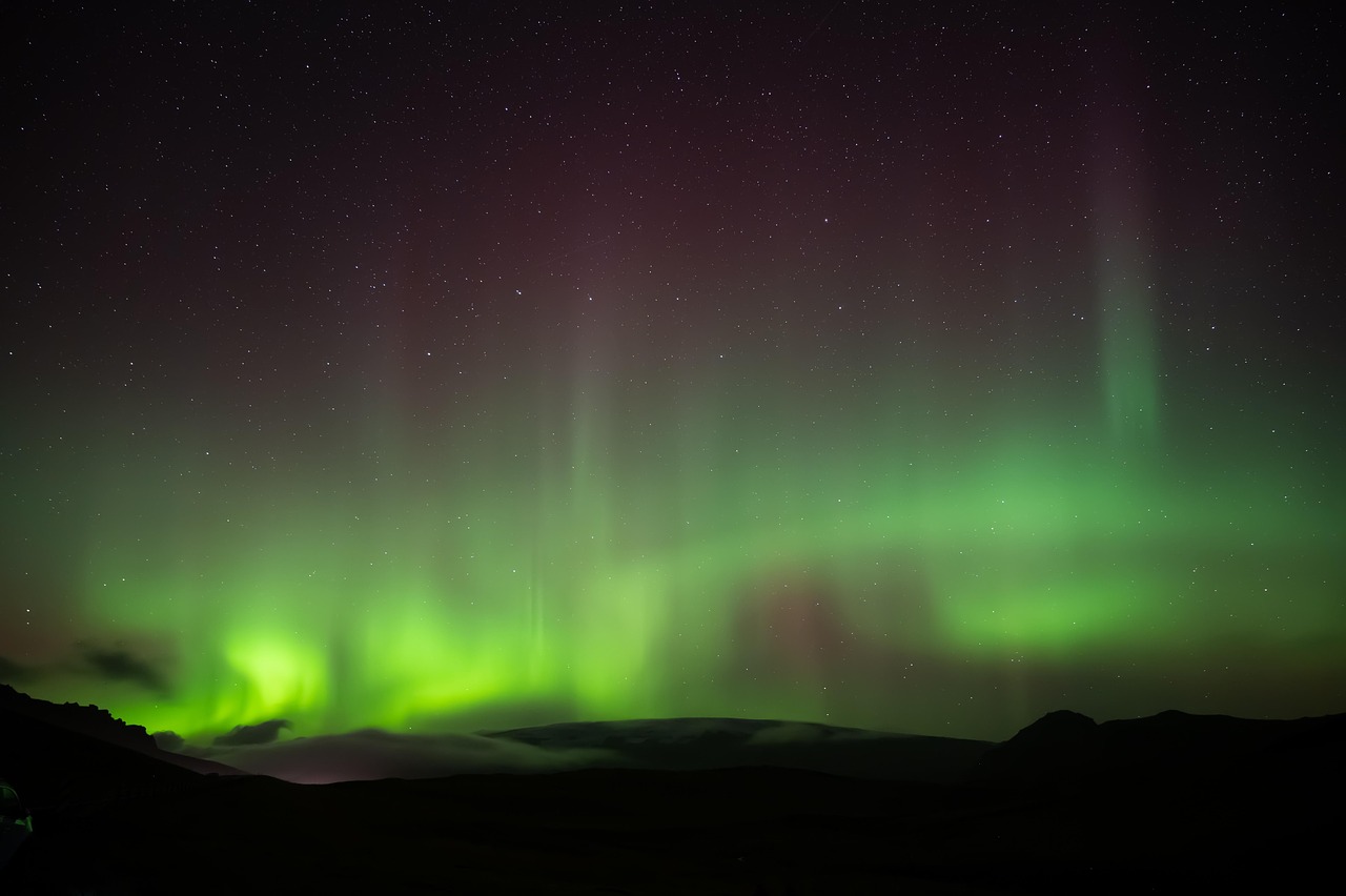
Hunting the northern lights
The outing starts with a read of the geomagnetic activity forecast and the cloud cover, then the guide drives towards an open area far from any lights. The wait can drag on, and the show plays out in a few minutes: a green veil, motionless at first, that suddenly starts rippling from one end of the sky to the other.
The activity suits everyone, families included, as long as you accept a late night and the cold. It runs from September to April only, never from late April to mid-August because of the midnight sun. On your own it costs nothing: drive away from your accommodation and switch off the headlights. Bring several layers, thick gloves and a tripod if you are shooting photos.
- 3 to 4 hours on a guided tour, or free on your own
- Free on your own, EUR 60-90 per person on a guided tour
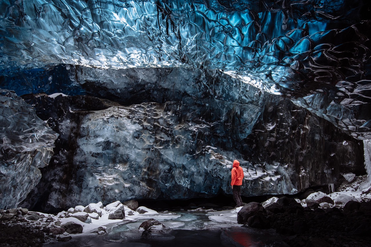
Glacier hike or ice cave
The guide hands out crampons, harness and ice axe at the foot of the glacier tongue, then the rope team works its way between crevasses and moulins where meltwater vanishes. The high point comes in the natural blue caves, only accessible from November to March out of Jökulsárlón, when light passes through several metres of compacted ice.
The introductory version runs on Sólheimajökull in the south or on the Vatnajökull tongues from Skaftafell; no prior experience is required, but you need stiff, high-cut hiking boots. One warning: since July 2026, safetravel.is advises against venturing alone onto Sólheimajökull, where a lagoon has formed east of the tongue with an unstable ice ridge and rockfalls. A guide is no longer optional there.
- 2h30 to 4 hours depending on the tour
- From 8,490 ISK (~EUR 60) for an intro walk, EUR 150-200 for hike + ice cave
Geothermal bath
You go through the changing rooms, shower thoroughly as Icelandic custom demands, and step into water at 36-40 °C while the outside air sometimes hovers near zero. The high point is simple: staying still in the pool while it snows or the wind blows, without feeling cold for a second.
The activity suits everyone, at any time of year, with no booking at municipal pools. The Blue Lagoon starts at 11,990 ISK on the Comfort package with dynamic pricing, the Sky Lagoon around 9,490 ISK on the Pure pass, and the Earth Lagoon at Mývatn from 7,900 ISK, open 10 am to 11 pm, 89 km from Akureyri. The village municipal pool, at around 1,200 ISK, stays the best value in the country.
- 2 to 3 hours
- From EUR 8 (municipal pool, ~1,200 ISK) to EUR 85 (Blue Lagoon Comfort, ~11,990 ISK)
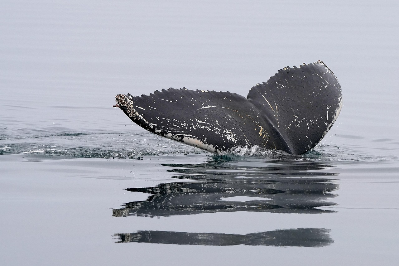
Whale watching at Húsavík
The traditional oak boat leaves the harbour and heads into Skjálfandi bay, one of the most reliable whale-watching areas in northern Europe. You come across humpbacks, minke whales and white-beaked dolphins; the high point stays the sounding, when the tail rises vertically before the dive.
The trip lasts about 3 hours and works well for families: it is free for under-7s, and the child rate for ages 7 to 15 is 6,490 ISK. A warm overall is provided on board, but bring a hat and gloves. The season runs from 1 April to 30 November; book the day before in July and August.
- about 3 hours
- 12,490 ISK adult (~EUR 88), 6,490 ISK child aged 7-15 (~EUR 46)
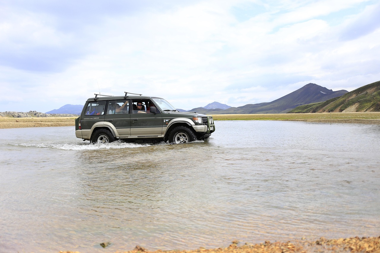
Super-jeep trip into the highlands
The raised vehicle leaves the tarmac and takes to the tracks towards Landmannalaugar, Þórsmörk or Askja, depending on the package. The high point is the river crossings: the 4x4 enters the water, it rises above the wheels, and you understand at once why these routes are off-limits to ordinary rental cars.
The day runs 8 to 12 hours and suits people happy with a long, often bumpy immersion. The main benefit is legal as much as technical: the operator carries the risk of the fords, which rental insurance systematically excludes. Bring warm clothes, a packed lunch and a swimsuit for the hot springs at Landmannalaugar.
- full day, 8 to 12 hours
- EUR 150-250 per person
Getting there
The vast majority of travellers land at Keflavík international airport (KEF), 50 km from Reykjavík, the only air gateway for long and medium-haul flights.
Keflavík handles the international traffic. It is where you pick up your rental car, often right at the terminal or a few minutes away by shuttle. Reykjavík has a second airport, RKV, but it only serves domestic flights and Greenland.
Two other airfields can work as an entry or exit point on a modified route: Akureyri (AEY) in the north and Egilsstaðir (EGS) in the east. They let you cut the loop in half if you are short on days, at the cost of an extra domestic flight.
There is also a sea route, rarer and slower. Smyril Line's Norröna ferry links Hirtshals in Denmark to Seyðisfjörður via Tórshavn in the Faroe Islands. It is the only vehicle connection between Iceland and the continent: you can bring your own car, which completely changes the economics of a long stay.
From Keflavík, the drive to Reykjavík takes just under an hour on Route 41. Many travellers prefer to sleep near the airport on the first night and start the Golden Circle in the morning, rather than lose half a day in the capital.
Getting around
A two-wheel drive is enough on Route 1 in summer since all 1,309 km are paved; a 4x4 becomes legally mandatory on F-roads and very useful in winter.
A car is the only realistic way to circle the island. Public buses exist but serve the natural sites poorly, and their timetables do not fit a ten-day itinerary. Wind is the number one hazard of Icelandic driving, well ahead of snow: gusts rip doors off their hinges, and insurance never covers that damage. Always hold the handle firmly as you open.
A few reflexes are quick to learn and save you real trouble:
- Headlights on day and night, all year round, is a legal requirement.
- Speed limits: 50 km/h in built-up areas, 80 km/h on gravel, 90 km/h on paved roads.
- Slow down before the paved-to-gravel transition, not during it: that is exactly where drivers lose control.
- Stop and give way at single-lane bridges.
- Sheep roam free from May to September, including on Route 1.
- Sandstorms in the south, on the Mýrdalssandur and the Skeiðarársandur, strip the paint off cars.
- Off-road driving is strictly forbidden, sand and moss included.
The Vaðlaheiðargöng tunnel in the north runs 7.4 km and shortens the drive by 16 km. It is the country's only toll. Before any trip into the highlands, registering on safetravel.is is mandatory.
What to do
Twelve sites structure the loop: Jökulsárlón, Þingvellir, Geysir, Gullfoss, Reynisfjara, Skógafoss, Seljalandsfoss, Mývatn, Dettifoss, Kirkjufell, Seyðisfjörður and Akureyri.
A tour of Iceland reads as a run of contrasts. The south-west concentrates the geothermal and the tectonic with the Golden Circle. The south coast lines up waterfalls and black sand. The south-east tips into the glacial world of Vatnajökull, added to the UNESCO World Heritage list on 5 July 2019. The north brings back active volcanoes around Mývatn.
Five experiences round out the sites themselves: hunting the northern lights, walking on a glacier or inside an ice cave, soaking in a geothermal bath, whale watching at Húsavík and a super-jeep trip into the highlands.
One question always comes up: should you fit everything in? No. Over ten days, better to nail three experiences than to book five and spend your days chasing departure times. Icelandic weather cancels boat trips and glacier walks without warning, and an overstuffed programme leaves no room to reschedule.
The detail of each site and each activity, with 2026 prices and on-the-ground advice, comes further down this guide.
Food
A cheap meal costs roughly 2,000 to 3,500 ISK and a mid-range dish 4,000 to 7,000 ISK, against 2,500 to 3,500 ISK of daily groceries at Bónus.
Eating out every evening nearly doubles the budget of an Icelandic road trip. The solution most travellers use is to cook in the guesthouse or at the campsite, and to treat themselves to a restaurant only two or three times over the trip.
Bónus is the discount chain of reference, recognisable by its pink pig. The trap is the opening hours: stores close markedly earlier than most visitors expect, even at the height of the season. Shop before 6 pm, or you fall back on a petrol station at triple the price.
The ballpark figures worth remembering:
- Cheap meal: around 2,000 to 3,500 ISK, or €14-25.
- Mid-range dish: around 4,000 to 7,000 ISK, or €28-49.
- Daily groceries at Bónus: around 2,500 to 3,500 ISK per person.
On the food itself, look out for the lamb soup served everywhere, the catch of the day in the ports, skyr at breakfast and the Icelandic hot dog, the national snack that gets you through between two stops.
Itineraries
Ten days counter-clockwise from Reykjavík add up to about 1,820 km including detours, in stages of 100 to 350 km, or 2 to 4 hours of daily driving excluding stops.
Going counter-clockwise has a concrete advantage: it puts the Golden Circle and the south coast at the start, while motivation is intact, and keeps the long eastern transfers for mid-trip. Here is the day-by-day breakdown, with real distances and driving times, stops not included.
- D1 - Reykjavík and the Golden Circle (Þingvellir, Geysir): about 120 km, 2 hours of driving. Leave the capital, Þingvellir 49 km to the east, then the Haukadalur geothermal field. Night around Selfoss or Flúðir.
- D2 - Gullfoss and down to the south coast: about 130 km, 2 hours. Gullfoss in the morning, Kerið as an option (700 ISK), then back onto Route 1 heading east. Night near Hvolsvöllur.
- D3 - South coast waterfalls and Vík: about 110 km, 1 hr 45. Seljalandsfoss, Skógafoss and Reynisfjara. The shortest day in kilometres and the densest in stops. Night in Vík í Mýrdal.
- D4 - Vík to Jökulsárlón: about 190 km, 2 hrs 30. Crossing the Mýrdalssandur and the Skeiðarársandur, a stop at Skaftafell, arrival at the glacier lagoon and Diamond Beach. Night near Höfn.
- D5 - Eastfjords to Egilsstaðir: about 260 km, 3 hrs 30 to 4 hrs. The longest transfer of the trip, on a road that follows every fjord. Optional detour to Seyðisfjörður, 27 km on Route 93 with its 620 m pass. Night in Egilsstaðir.
- D6 - Egilsstaðir to Mývatn via Dettifoss: about 250 km, 3 hrs 30. Across the Möðrudalur plateau, then Dettifoss from the west bank (Route 862, paved). Night at Lake Mývatn.
- D7 - Mývatn and Húsavík: about 130 km round trip, 2 hours. Dimmuborgir, Hverir and Krafla easily fill a full day; the alternative is the whale-watching trip at Húsavík, 50 km to the north. Second night at Mývatn.
- D8 - Mývatn to Akureyri: about 100 km, 1 hr 15, with Goðafoss on the way. Akureyri is the last real resupply before the west. Night in town.
- D9 - Akureyri to Snæfellsnes: about 350 km, 4 hrs 30. The longest driving day, broken by the Vaðlaheiðargöng tunnel at the start (2,216 ISK) and a break at Blönduós. Arrival at Kirkjufell in late afternoon. Night near Grundarfjörður or Stykkishólmur.
- D10 - Snæfellsnes to Reykjavík: about 180 km, 2 hrs 30, via the Hvalfjörður tunnel, free since 28 September 2018. Back to the capital or straight to Keflavík, 50 km further on.
The imbalance between the days is deliberate. Two days of 260 and 350 km frame the heart of the north and let you keep three short days where the sites come thick and fast. The classic mistake is to smooth everything to 200 km a day: you then race through the south coast and get bored in the east.
In winter, keep the same skeleton but spread it over 12 to 14 days. Days of 4-5 hours of light in December do not allow 350 km and sightseeing in the same day.
Climate & seasons
When to go to Iceland?
Monthly averages over the past 5 years (Open-Meteo).
Avoid
- January
- February
- March
- April
- May
- October
- November
- December
| Jan | Feb | Mar | Apr | May | Jun | Jul | Aug | Sep | Oct | Nov | Dec | |
|---|---|---|---|---|---|---|---|---|---|---|---|---|
| Our take | ||||||||||||
| Weather | ||||||||||||
| High | -5° | -4° | -4° | -1° | 3° | 8° | 12° | 10° | 6° | -0° | -2° | -5° |
| Rain (mm) | 99 | 100 | 102 | 49 | 60 | 74 | 62 | 74 | 99 | 91 | 73 | 72 |
When to go
The best months for the Ring Road run from June to September; September-October and February-March offer the best trade-off between dark nights for auroras and drivable roads.
Two calendars compete in Iceland, and you have to pick one. The northern lights are visible from September to April, once the nights turn dark again. The midnight sun runs from late April to mid-August, with a sun that barely sets around 21 June. The two are incompatible: no period gives you both.
From June to September, the secondary roads are open, the days are long and boat trips are reliable. It is the easiest window for a first loop. September and October, then February and March, combine nights dark enough for auroras with a Route 1 that is still drivable.
November to February stays the hardest stretch: you drop to 4-5 hours of usable daylight in December, with frequent temporary closures. Route 1 stays open all year, but winter calls for 12 to 14 days rather than 10.
The F-roads of the highlands follow no fixed calendar. Vegagerðin opens them after inspection: the F35 (Kjölur) usually in the first two weeks of June, the F26 (Sprengisandur) more often in late June or early July. Treat those as ballpark dates and check them on umferdin.is.
Budget
Budget €110 per person per day on a shoestring, €210 in comfort and €400 at the high end, so roughly €1,100, €2,100 or €4,000 for ten days.
The heaviest line item stays the vehicle plus accommodation combination, ahead of fuel. Rental rates, as quoted by the companies, should be read as ballparks: around €25-45/day for a 2WD in low season and €55-135/day in high season; €75-95/day for a 4x4 in shoulder season and €85-150/day in summer. Roughly speaking, the mid-range daily figure sits near US$230 or £180.
Fuel comes on top. As of 07/08/2026, petrol runs from 200.10 ISK/L at Orkan to 230.90 ISK/L at N1, or about €1.41-1.63/L. Diesel ranges from 228.30 to 252.90 ISK/L.
The real budget trap of 2026 shows up on no flight comparison site. Since 1 January 2026, the kílómetragjald has replaced the old fuel tax: 6.95 ISK per kilometre for vehicles of 3.5 t and under. Rental companies pass it on to the customer. Over the 1,820 km of this itinerary, that comes to roughly 12,650 ISK, close to €89 that never appears in the initial quote.
Parking at the major sites is now paid, and you have to factor it in: Þingvellir 1,000 ISK for the day, Skaftafell and Jökulsárlón 1,110 ISK, Kerið 700 ISK. Seljalandsfoss and Skógafoss sit around 1,000 ISK according to visitor reports.
Where to stay
Expect roughly €90-175 a night in a guesthouse, the dominant format along the Ring Road, with availability drying up very fast in July and August.
Accommodation weighs heavily on an Icelandic budget, often as much as the vehicle. The guesthouse is the go-to formula outside Reykjavík: simple room, sometimes shared bathroom, kitchen you can use. Rates advertised on booking platforms hover around €90-175 a night, a ballpark that climbs sharply in high season.
The logic of a ten-day loop is to set up a base for two nights in the rich areas, and to do single nights on the connecting legs. Two nights near Vík or Kirkjubæjarklaustur in the south, two nights around Mývatn in the north: that saves you unpacking every evening.
Camping stays the cheapest and most flexible option, with a network of municipal sites open mainly from June to September. Wild camping, on the other hand, is forbidden outside designated vehicle areas.
One practical point people often skip: book the south-east nights early, between Skaftafell and Höfn. The area has few beds for a lot of visitors, and it is the first place where you end up driving an extra hour in the evening for lack of a room.
Safety
The single emergency number is 112, and the "112 Iceland" app automatically sends your GPS position to rescuers, which changes everything in empty areas.
Iceland is a very safe country when it comes to crime. The risks are natural, and preparation handles them. Install the 112 Iceland app as soon as you land: the emergency button sends your coordinates, and a second button leaves a trace of your passage that rescuers can use.
Three dangers dominate a loop of the island:
- Wind, capable of tearing off a door or destabilising a high-sided vehicle on exposed sections.
- The sneaker waves at Reynisfjara, which run up the beach with no warning. Several deaths have been recorded there in recent years. A traffic light has been installed at the entrance: yellow means stay alert, orange requires you to keep at least 25 m from the water, red closes the beach and limits the visit to the viewpoint. Never turn your back on the sea.
- Volcanism, with more than 100 active volcanoes and eruptions triggered at short notice.
One alert is still live as this is written. Since July 2026, safetravel.is advises against venturing alone onto Sólheimajökull: a lagoon has formed east of the glacier tongue, the ice ridge is unstable and rockfalls occur. A guide is now essential there.
The daily reflex of the Icelandic road-tripper: check umferdin.is for road conditions and safetravel.is for travel conditions, every morning before taking the wheel.
Formalities
No visa is required for EU, EEA and Swiss citizens: Iceland has been in the EEA since 1994 and in the Schengen Area, with stays free for up to three months.
Iceland is not part of the European Union, but it has belonged to the European Economic Area since 1994 and to the Schengen Area. EU, EEA and Swiss citizens need only a national ID card or a passport valid for the whole of their stay. No three or six-month residual validity rule applies here.
UK, US, Canadian and Australian visitors can stay up to 90 days in any 180-day period without a visa, and will need ETIAS authorisation once it launches. Whatever your nationality, carry a passport valid for the whole of your stay: it is the document that causes the fewest problems, particularly in transit.
Beyond three months, registration with the Icelandic national register, Þjóðskrá, becomes necessary.
On health, no vaccine is required. A measles alert was published on 13 March 2026, so it is a good moment to check that your MMR is up to date before leaving. The European Health Insurance Card is valid in Iceland; order it several weeks ahead if you are entitled to one.
An underrated practical point: Iceland runs almost entirely without cash. Cards work everywhere, but a four-digit PIN is essential at the automated fuel pumps, which are common outside towns. Check that with your bank before you leave, or you may not be able to fill up on a Sunday evening.
Official details on the France Diplomatie website.
Tips
The country's best-value tip stays the village municipal pool, around 1,200 ISK, roughly ten times cheaper than the Blue Lagoon and its 11,990 ISK minimum.
Travellers coming back from a Ring Road loop nearly all mention the same thing: the municipal pools, not the famous lagoons. Every village has one, heated with geothermal water and used by locals. That is where you end up talking to Icelanders, for around 1,200 ISK.
A few habits that save time and money:
- Fill up as soon as the gauge drops to half in the east: stations are far apart there.
- Bring a water bottle. Tap water is excellent and free, bottled water is expensive and pointless.
- Pack a genuinely waterproof jacket and a camera cover, both essential under the waterfalls.
- Keep light crampons in the boot from November to March for icy trails.
- A head net for Mývatn between June and August, or the midges ruin the day.
- Pay for the Jökulsárlón car park on the same day as Skaftafell: the 50% discount applies.
One last piece of advice, less material. Icelandic weather changes several times a day. A site missed in morning rain often turns magnificent in late afternoon. Leave at least half a day of slack in the plan so you can double back.
FAQ
No, a 4x4 is not needed on the Ring Road in summer since all 1,309 km are paved; it becomes legally mandatory as soon as you take an F-road.
Do you need a 4x4 for the Ring Road?
No. Route 1 is paved along all 1,309 km, and a two-wheel drive is plenty in summer. A 4x4 becomes mandatory in the legal sense on the F-roads of the highlands. It adds real comfort in winter, and on gravel approaches such as the east bank of Dettifoss (Route 864).
What budget should you plan for 10 days in Iceland?
Expect around €1,100 per person on a shoestring, €2,100 in comfort and more than €4,000 at the high end, so €110, €210 or €400 a day. The heavy items are the vehicle, accommodation and fuel. Conversion reference: 1 EUR = 141.80 ISK as of 05/08/2026.
Can you drive the Ring Road in winter?
Yes, Route 1 stays open all year, apart from temporary closures. Plan 12 to 14 days instead of 10, a 4x4 with studded tyres, and a look at umferdin.is and safetravel.is every morning. In December, daylight drops to 4-5 hours a day. The F-roads are completely closed.
How long does it take to drive around Iceland?
The loop is 1,309 km, or 16 to 20 hours of pure driving with no stops at all. Ten days is the balanced format, with 2 to 4 hours on the road a day and time to visit. Under seven days, the trip becomes a chain of transfers with no breathing room.
When can you see the northern lights in Iceland?
From September to April, when the nights are dark enough. It is impossible from late April to mid-August because of the midnight sun, which never leaves enough darkness. September-October and February-March offer the best trade-off between dark nights and drivable roads.
What is the price of petrol in Iceland in 2026?
As of 07/08/2026, petrol ranges from 200.10 to 230.90 ISK/L depending on the chain, or about €1.41-1.63/L. On top of that comes the kílómetragjald, in force since 1 January 2026: 6.95 ISK per kilometre, close to €89 over the 1,820 km of this itinerary, passed on by the rental company.
Are there tolls in Iceland?
Just one: the Vaðlaheiðargöng tunnel, at 2,216 ISK per crossing, payable on veggjald.is within 24 hours before or after. The Hvalfjörður tunnel has been free since 2018. Parking at the major sites, however, is paid: Þingvellir 1,000 ISK, Skaftafell and Jökulsárlón 1,110 ISK, Kerið 700 ISK.
When do the highland F-roads open?
There is no fixed calendar: Vegagerðin opens each road after inspection. Generally, the F35 (Kjölur) opens in early June and the F26 (Sprengisandur) in late June or early July. Those are ballpark dates; check the real state of the roads on umferdin.is before setting off.
Sources
The figures in this guide come from the sources below, checked on the publication date.
- www.diplomatie.gouv.fr
- www.diplomatie.gouv.fr
- safetravel.is
- safetravel.is
- www.veggjald.is
- www.skatturinn.is
- bensinverd.is
- www.vatnajokulsthjodgardur.is
- www.thingvellir.is
- whc.unesco.org
- www.vatnajokulsthjodgardur.is
- www.ecb.europa.eu
- en.wikipedia.org
- www.gentlegiants.is
- www.earthlagoon.is
- safetravel.is
Leave a comment
Share your thoughts or travel experience. Your email will not be published.