

Contents 28
Overview
Namibia covers 825,000 km² with just 2.6 million inhabitants, one of the lowest population densities on earth — that emptiness, paired with a usable network of gravel roads, is what makes it the self-drive destination.
Namibia comes down to a simple equation: vast distances, very few people, and landscapes that change completely every 300 kilometres. You drive for hours without meeting anyone, between a desert that runs into the Atlantic, rust-coloured rocky plateaus, and a salt pan large enough to be visible from space.
The country is travelled almost entirely by private vehicle. There is no public transport network serving the tourist sites, and the distances make day trips unrealistic. That constraint is also what gives the trip its character: you build your own route, and you manage your own fuel, water and stops.
- Capital: Windhoek (around 430,000 inhabitants)
- Currency: Namibian dollar (NAD), pegged 1:1 to the South African rand, which is also legal tender
- Official language: English; Afrikaans and German are still widely spoken
- Time zone: same as London in winter, one hour behind in summer; one hour behind Paris year-round in summer
- Driving: on the left
10 places to take with you
In the guide's order, ready for Google Maps or your GPS.
Book the activities from this guide
Our picks for Namibia, well rated and free to cancel.
-
Book this activity
Self-drive 4x4 safari in Etosha National Park
Entrée du parc par personne et par jour, plus le forfait véhicule ; camping NWR en sus
Affiliate links: Travel Advice earns a commission if you book, at no extra cost to you. Learn more

Sossusvlei and Deadvlei
At five in the morning the sand is still cold underfoot, and the only thing moving is the line of shadow retreating along the ridge as the sun climbs.
Sossusvlei is a clay pan ringed by some of the highest dunes on earth, reaching nearly 380 metres. The Namib that holds them has been a UNESCO World Heritage Site since 2013, listed as the Namib Sand Sea. A few hundred metres away, Deadvlei holds the country's most reproduced image: camel thorn trees dead for centuries, blackened by the sun, standing in cracked white clay.
Access is from the Sesriem gate, along 60 km of tarred road and then 5 km of soft sand that only 4x4s can cross — a paid shuttle takes over for other vehicles. On site, you climb Dune 45 or Big Daddy, then walk on to Deadvlei in about twenty minutes.
It is the only place in the country where three radically different landscapes — living dune, clay pan and fossil forest — sit within walking distance of each other.
Carry water and start climbing before 8am: after 10am the heat on the sand makes the ascent genuinely punishing.

Damaraland
A red track runs between black basalt hills, and for tens of kilometres nothing suggests another human has passed this way.
This mountainous, arid region in the north-west shelters one of the last populations of black rhino living free outside fenced reserves, along with desert-adapted elephants able to cover dozens of kilometres between waterholes. Brandberg, the country's highest point at 2,573 metres, dominates its western edge.
You travel it on demanding tracks, stopping at Twyfelfontein, the Organ Pipes or the Vingerklip. Lodges organise tracking outings with accredited guides — the only realistic way to hope for a rhino sighting.
This is the region that gives real meaning to "off the beaten track" on a Namibian itinerary: unlike Etosha or Sossusvlei, you can drive here all day without meeting another vehicle.
Fill up in Khorixas or Uis before heading in: stations are rare and far apart across the whole region.

Etosha National Park
You cut the engine at a waterhole, and all that's left is the wind and the scrape of hooves: in Etosha, a safari is mostly about waiting in the right place.
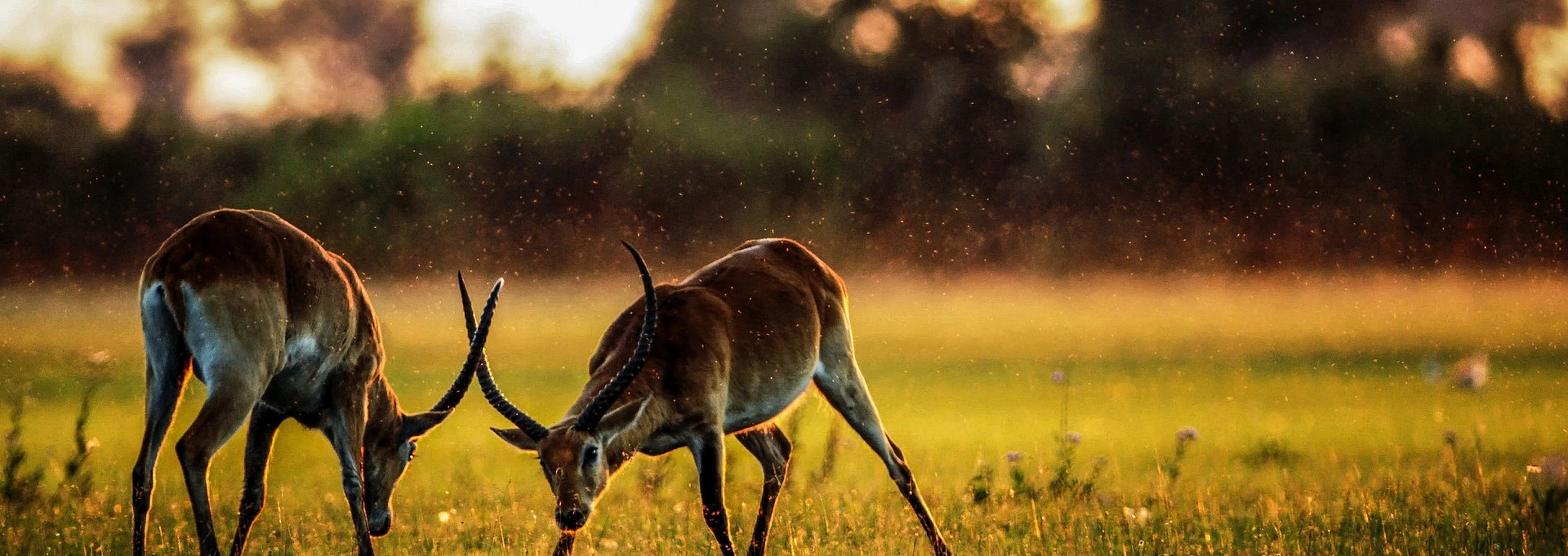
The park covers more than 22,000 km² around an immense salt pan, a depression large enough to be identifiable from space. Elephants, lions, giraffes, zebras, oryx and both species of rhino — black and white — live here, alongside abundant birdlife.
What sets it apart is how you visit: everything is done from your own vehicle, with no compulsory guide, driving from one built waterhole to the next on a network of marked tracks. The rest camps have floodlit waterholes where you settle in after dark to watch rhino and elephant come down to drink.
No other major park in southern Africa offers this degree of independence: here you build your own safari, without relying on an operator.
Book the rest camps (Okaukuejo, Halali, Namutoni) months ahead for high season — they are what give you access to the floodlit night waterholes.

Fish River Canyon
You arrive along a flat, monotonous gravel road, and the chasm opens all at once, without warning, a few metres from the car park.
The largest canyon in Africa and one of the biggest in the world, it runs roughly 160 km with walls reaching 550 metres deep. The Fish River below is reduced to a string of pools in the dry season.
The main viewpoint, near Hobas, is a few minutes' walk from the car park and is enough to grasp the scale of the place. Experienced hikers can descend into the canyon itself on a three- to five-day trek, permitted from mid-April to mid-September only and subject to a medical certificate.
This is the stop that justifies the drive into the far south: far less visited than the Sossusvlei–Etosha corridor, it offers sunsets on the canyon walls with nobody else around.
The full trek must be booked well in advance with the park authorities and requires a medical certificate — it is not something you can decide on the spot.

Twyfelfontein
The guide stops in front of a block of red sandstone, points, and a giraffe appears where you had seen nothing but rock.
This Damaraland site holds one of the largest concentrations of rock art in Africa, with close to 3,000 recorded engravings — estimates run beyond 5,000 — most of them made around 6,000 years ago by hunter-gatherers, then added to by the Khoikhoi. Inscribed as a UNESCO World Heritage Site in 2007, it was the first Namibian site to receive the distinction.
The visit is on foot, on two marked circuits of about an hour each, through a jumble of sandstone boulders. The engravings mostly depict animals — giraffes, rhinos, lions, tracks — and were probably used to pass on knowledge about wildlife and water sources.
Unlike the paintings at nearby Brandberg, these are incised engravings: more legible, and far better preserved.
Come early in the morning — the site is fully exposed and there is no shade at all from 11am onwards.

Swakopmund
After five days of gravel and dust, you emerge onto a seafront promenade lined with half-timbered houses, and the contrast is frankly disorienting.
Founded by German colonists in the late 19th century, Swakopmund has kept a remarkably well-preserved Jugendstil architecture, wedged between the cold Atlantic and the Namib dunes. Coastal fog rolls in most mornings, sustained by the Benguela current.
It is the logistical base of any self-drive trip: well-stocked supermarkets, garages, laundries, fuel stations and ATMs. You stay a night or two to catch your breath, eat fresh fish and wash the car before heading north.
It is also the only place in the country where you can fit a museum visit, a proper restaurant and a quad-bike ride on the dunes into a single day.
Pack warm clothes even in summer — fog and wind often hold the coast around 15°C while it is 35°C just 100 km inland.

Skeleton Coast
The fog erases the horizon, the temperature drops ten degrees in a few kilometres, and the track runs alongside an ocean you can hear without always seeing it.
This coast takes its name from the countless shipwrecks caused by permanent fog and the cold Benguela current: rusting hulls and whale bones punctuate the sand. The San called it "the land God made in anger".
You drive it south to north from Swakopmund, stopping at the Cape Cross fur seal colony — tens of thousands of animals, and a smell you won't forget — before entering the park proper, whose northern access requires a permit and a declared itinerary.
It is the exact opposite of Sossusvlei: where the southern desert is bright and graphic, the Skeleton Coast is grey, loud and hostile — and that is precisely what makes it memorable.
Check opening hours and access conditions before heading north: the gates close early and entry is not permitted late in the day.

Kolmanskop
You push open a door, and the sand has risen halfway up the windows, in a drawing room where the wallpaper still clings to the walls.
This German mining town boomed in the early 20th century, when diamonds could be picked up straight from the desert sand. It had a hospital with the first X-ray machine in the southern hemisphere, a ballroom, a bowling alley and an ice factory. Once the seam ran out it was abandoned in the 1950s, and the dunes took the ground back.
The visit consists of walking freely between the buildings, some filled with sand to ceiling height while others remain almost intact. Allow two to three hours to go round without rushing.
It is one of the few sites of its kind in the world where you walk inside the buildings rather than viewing them from behind a barrier.
The site is only 10 km from Lüderitz: sleep there rather than making a round trip from further away.

Spitzkoppe
The granite shifts from ochre to blood red in the twenty minutes after sunset, and the rock arch cuts a silhouette against a sky filling with stars.
Nicknamed the "Matterhorn of Namibia", this cluster of isolated granite peaks reaches 1,728 metres above sea level and rises some 700 metres above a perfectly flat plain. The massif is among the oldest rock formations in southern Africa.
You walk freely between the boulders, reach the natural arch in a few minutes, and can see rock paintings in some of the shelters. The community campsite at the foot of the peaks lets you sleep on site, without electricity or light pollution.
It is the best stargazing spot on a classic Namibian itinerary, and it sits right on the road between Swakopmund and Damaraland.
Bring all your water and food — there is no shop or restaurant on site, only basic facilities.

Lüderitz
You drive 120 km in a straight line between dunes spilling onto the tarmac, and a small German town of colourful houses appears on the edge of the Atlantic.
This isolated port, founded in 1883, has kept an Art Nouveau and Jugendstil architecture that feels incongruous at this latitude, crowned by the Felsenkirche Lutheran church perched on its rock. The wind blows here almost constantly.
Most travellers come for the logistical base it provides for Kolmanskop, 10 km away, and for the Lüderitz peninsula, where you can watch seals, flamingos and sometimes African penguins from Diaz Point.
Few travellers push this far, and that is the appeal: the town has kept an end-of-the-world atmosphere that the classic circuit's stops have lost.
Never leave the road to reach the coast south of town: the area is a restricted diamond concession, and checks are strict.

Sunrise over the Sossusvlei dunes
Leave the Sesriem campsite before dawn, 60 km of tarred road in the half-light, then the last 5 km of soft sand in a 4x4. You climb Dune 45 or Big Daddy as the sun comes up — 45 minutes to an hour and a half depending on the dune, one step back for every two forward. The high point comes at the top: the light flips over and the shadows carve out every ridge for kilometres.
Within reach of anyone in reasonable shape, but punishing once the heat builds: head back down before 10am. Carry 2 litres of water per person, a hat and something to protect your camera from sand. No booking needed — entry is paid at the Sesriem gate.
- Demi-journée, 4 à 5 h depuis Sesriem
- Droit d'entrée du parc, quelques euros par personne et par jour, plus le forfait véhicule
Self-drive 4x4 safari in Etosha National Park
You enter through the Andersson or Von Lindequist gate, park map on your lap, and drive from one waterhole to the next at your own pace — no guide, no fixed schedule. The rule is simple: stay in the vehicle, cut the engine, and wait. The high point often comes late in the day at Okaukuejo, when rhino and elephant take turns at the floodlit waterhole.
Suitable for everyone, families included, since it all happens from the car. Book the rest camps months ahead in high season, bring binoculars for each person, and fill up before entering: fuel stations inside the park are few.
- 1 à 3 jours
- Entrée du parc par personne et par jour, plus le forfait véhicule ; camping NWR en sus

Tracking black rhino in Damaraland
Set off at dawn in an open 4x4 with a tracker, who reads prints and dung to locate the animals, then approach on foot for the last few hundred metres, into the wind and in silence. Observation is from a safe distance, often from a ridge. The high point isn't only the animal: it's the reading of the ground, narrated step by step.
Requires decent walking over rocky terrain and is not suitable for young children. Book through your lodge or an accredited operator; closed shoes are compulsory, neutral clothing recommended. Success is never guaranteed — this is free-ranging, unfenced wildlife.
- Demi-journée à journée complète
- 80 à 150 € par personne selon l'opérateur
Exploring the ghost town of Kolmanskop
You collect your permit, then move freely from building to building: the theatre, the hospital, the machine hall, and above all the houses where sand has filled the rooms up to the windows. A guided tour runs in the morning for the history of the site. The high point is walking through rooms where raking light carves perfectly smooth indoor dunes.
Accessible to all, though the ground is sandy and uneven. The photography permit, sold in Lüderitz or at the entrance, allows earlier access before the groups arrive — that's the one to buy if you want the rooms to yourself.
- 2 à 3 h
- Permis d'environ 10 à 15 € par personne
Fish River Canyon: viewpoint or full trek
From the Hobas viewpoint, a few minutes' walk is enough to take in the meanders and the 550 metres of drop. Seasoned hikers can commit to the canyon itself: 85 km over three to five days, fully self-sufficient, camping by the river. The high point of the trek is the initial descent, steep and technical, which drops you into another world all at once.
The viewpoint suits everyone, families included. The trek is for experienced walkers only, permitted from mid-April to mid-September, on presentation of a medical certificate and a permit booked well in advance with the park authorities — confirm the exact dates for the current season with them.
- 1 h pour le point de vue, 3 à 5 jours pour le trek intégral
- Droits d'accès modiques pour le point de vue ; permis et certificat médical pour le trek
Getting there
There are no direct flights from Europe to Namibia: expect one stop in Frankfurt, Doha, Addis Ababa or Johannesburg, and 14 to 20 hours to Windhoek's Hosea Kutako International Airport.
Hosea Kutako International Airport (code WDH), 45 km east of Windhoek, handles most international arrivals. The most common routings go through Frankfurt, Doha, Addis Ababa or Johannesburg. Expect €650 to €1,100 (roughly $700–1,200 / £560–950) return from Paris or London depending on the season, with rates climbing sharply in July–August and over the end-of-year holidays.
Walvis Bay airport is a useful alternative if you plan to start your circuit on the coast: it is served from Johannesburg and Cape Town, and saves you the 400 km between Windhoek and Swakopmund.
Most 4x4 rental agencies are based in Windhoek, either in town or near the airport. Plan a night there on arrival: collecting the vehicle, checking the camping equipment and doing your first shop takes half a day, and starting out on gravel roads late in the afternoon is a bad idea.
Getting around
A rented 4x4 is the only realistic way to get around: the UK government advises not exceeding 80 km/h on gravel roads, carrying two spare tyres, and avoiding driving at night outside towns.
Tarred roads (B-prefixed) link Windhoek, Swakopmund, Etosha and the south. Everything else — which means most of the sights — runs on gravel roads graded C or D: maintained, but treacherous, since the loose surface layer makes the vehicle slide the moment you brake hard or turn too quickly.
The official UK guidance is explicit: a maximum of 80 km/h on gravel, two spare tyres, plenty of water, checking road conditions before setting off, and above all no night driving outside towns — wildlife and livestock cross without warning. Accidents are common on gravel and dirt roads, and most rental insurance policies exclude single-vehicle accidents as well as collisions with animals: read the contract before you sign.
Two field rules complete the picture. Don't exceed 300 to 350 km of gravel per day: at a realistic 70 km/h average including photo stops, that already fills a day. And fill up at every fuel station you pass, even at half a tank — more than 200 km can separate two pumps, and some take cash only.
An International Driving Permit is strongly recommended alongside your national licence. Rental companies and police frequently ask for it as supporting identification.
What to do
Four experiences shape a Namibian road trip: sunrise over the Sossusvlei dunes, a self-drive safari in Etosha, the rock engravings of Twyfelfontein, and the landscapes of Damaraland.
Namibia is best understood as a sequence of regions rather than isolated sights: the Namib Desert in the south-west, the Atlantic coast around Swakopmund, Damaraland in the north-west, Etosha in the north, and the far south around Fish River Canyon.
Each site and activity is detailed further down this guide, with practical notes on access and timing.
Food
Namibian food blends German heritage with bush meat: boerewors, biltong, gemsbok and springbok dominate menus, with excellent fresh fish along the coast.
Meat takes the lead role. The braai — the local barbecue — is an institution: every campsite is equipped for it, and supermarkets sell beef, gemsbok (oryx) and springbok at very low prices. Biltong, spiced dried meat, is the obligatory companion for long gravel stretches.
German colonial heritage remains visible in Swakopmund and Windhoek: bakeries, beer brewed to the Bavarian purity law, cured meats. On the coast, at Swakopmund and Walvis Bay, the Walvis Bay oysters and fresh fish are worth the detour.
For supplies, the South African chains Spar, Pick n Pay and Checkers cover the main towns. Beyond them, village shops often stock little more than tinned food: do your shopping in Windhoek, Swakopmund or Otjiwarongo, and carry a minimum of 5 litres of water per person per day.
Itineraries
Two weeks cover the classic Windhoek – Sossusvlei – Swakopmund – Damaraland – Etosha loop; three weeks let you add the far south and Fish River Canyon.
Northern loop in 14 days (around 2,800 km) — the most common route, and the best balanced:
- Day 1: arrive in Windhoek, collect the 4x4, overnight in town
- Days 2–4: drive south to Sesriem, two nights for Sossusvlei and Deadvlei
- Days 5–6: north to Swakopmund through the Namib-Naukluft, a comfort stop and resupply
- Days 7–8: Spitzkoppe, then Damaraland and Twyfelfontein
- Days 9–12: Etosha, three nights split between the eastern and western camps
- Days 13–14: return towards Windhoek via Okonjima or the Waterberg
Grand loop in 21 days (around 4,200 km) — the same backbone, preceded by a run south: Fish River Canyon, Lüderitz and Kolmanskop, then back up to Sesriem along the desert road. This is the version that earns the phrase "off the beaten track": the south sees far fewer visitors than the Sossusvlei–Etosha corridor.
With fewer than ten days, drop the idea of a full loop and pick half the country. Trying to fit Sossusvlei and Etosha into one week means spending your days behind the wheel.
Three regions sit deliberately outside these routes: the Kalahari to the east, the Caprivi Strip in the north-east and the Kaokoland in the far north-west. Each needs an extra week, and Kaokoland requires travelling in two vehicles — they belong to a separate trip, not an extension of the classic loop.
Climate & seasons
When to go to Namibia?
Monthly averages over the past 5 years (Open-Meteo).
Best months
- January
- February
- March
- April
- May
- June
- July
- August
- September
- October
- November
- December
| Jan | Feb | Mar | Apr | May | Jun | Jul | Aug | Sep | Oct | Nov | Dec | |
|---|---|---|---|---|---|---|---|---|---|---|---|---|
| Our take | ||||||||||||
| Weather | ||||||||||||
| High | 29° | 31° | 31° | 31° | 29° | 25° | 25° | 27° | 29° | 31° | 31° | 30° |
| Rain (mm) | 24 | 22 | 35 | 9 | 0 | 0 | 0 | 0 | 1 | 1 | 4 | 4 |
| Hiking & nature | Hiking & nature June | Hiking & nature July | ||||||||||
| Safari & savanna | Safari & savanna January | Safari & savanna February | Safari & savanna March | Safari & savanna April | Safari & savanna May | Safari & savanna June | Safari & savanna July | Safari & savanna August | Safari & savanna September | Safari & savanna October | Safari & savanna November | Safari & savanna December |
What to do by season (autumn)
-
Safari & savanna
Dry season ideal for spotting wildlife.
When to go
The dry season, May to September, is the best time to go: gravel roads are in good condition, temperatures are manageable, and wildlife gathers at Etosha's waterholes.
From May to September it barely rains. Days are sunny and warm, nights genuinely cold in the desert — temperatures can drop below freezing at Sesriem in June and July. This is when wildlife concentrates around the few remaining waterholes in Etosha, which makes sightings far easier.
The rainy season runs from January to April. The UK government warns that many gravel roads deteriorate during this period, and some become temporarily impassable. Temperatures regularly exceed 35°C and the thick vegetation scatters the animals, but the landscapes turn green and visitor numbers drop sharply.
July to October is peak tourist season: 4x4 rental companies raise their rates and park campsites book out months ahead. May–June and September offer the best compromise between road conditions, wildlife and price.
Budget
Expect €45–65 per person per day camping, €65–120 in mid-range lodges and €120–180 in comfort — excluding international flights and the 4x4 rental.
The 4x4 is the biggest line in the budget, well ahead of accommodation. A Toyota Hilux fitted with a roof tent rents from around €64 per day excluding fuel, with surcharges of 50 to 100% between July and October. Travelling as a pair splits the cost; travelling solo, it hurts.
Fuel is the second line, and it is consistently underestimated. A 3,000 km loop in a 4x4 using 11 to 13 litres per 100 km works out at roughly €350–450 of diesel. Park entrance fees add to that, in the order of a few euros per person per day plus a vehicle charge — these rates are revised regularly by the Namibian authorities, so check them before you leave.
Camping keeps you at the bottom of the range without feeling like a sacrifice, especially since self-catering is simple and cheap. A lodge-based circuit with guided outings, by contrast, easily doubles the bill.
Work out your budget
Backpacker
315 – €455
45 – €65 per person per day
Mid-range
455 – €840
65 – €120 per person per day
Upscale
840 – €1,260
120 – €180 per person per day
On top of that
- International flights (return) 650 – €1,100
- Equipped 4x4 rental (fuel excluded) €448
- E-visa or visa on arrival (indicative) €82
Extras total €530
On-the-ground estimate, international flights excluded unless stated. Prices vary by season and how early you book. Figures updated on 14/09/2026.
Where to stay
Expect €15–25 per night for an equipped campsite, €60–120 for a guesthouse or mid-range lodge, and €200 and up for a high-end lodge with guided activities included.
Camping is the backbone of most self-drive trips. Namibian campsites are of a standard rarely found in Africa: your own water point, a built braai (barbecue) stand, clean facilities, often shade. Rental 4x4s come with a roof tent and full equipment, which makes the formula very flexible. Expect €15 to €25 per person per night.
Mid-range lodges and guesthouses (€60–120 for a double room) offer the comfort of a real bed and often a pool — welcome after a day on gravel. Namibia's high-end tier, from €200 per person, clusters around Sossusvlei and Damaraland, in isolated lodges that include guided outings.
Two bookings deserve to be made well ahead: the rest camps inside Etosha (Okaukuejo, Halali, Namutoni), run by Namibia Wildlife Resorts, whose floodlit waterholes sell out months in advance in high season; and the Sesriem campsite, the only accommodation inside the park's first gate, which gives you access to the dunes an hour before outside visitors.
Safety
Namibia is a safe self-drive destination: the main risk is not crime, which is concentrated in urban areas, but the road — gravel surfaces, wildlife crossing, and distance from emergency help.
Road risk dominates by a wide margin. Accidents are common on gravel and dirt roads, and rollovers caused by excessive speed or a sharp steering correction are the most frequent type of accident among visitors. Keep to 80 km/h maximum on gravel, don't drive at night outside towns, and bear in mind that medical help can be several hours away.
Crime is essentially urban and opportunistic: pickpocketing and burglaries in Windhoek, sometimes violent. The usual precautions are enough: leave nothing visible in the vehicle, avoid walking alone at night in town, use guarded parking. On gravel roads and in the parks, this risk is close to zero.
Take out repatriation insurance covering medical evacuation, and check what the rental company's policy excludes: most contracts cover neither single-vehicle accidents, nor collisions with animals, nor tyre and windscreen damage — precisely the incidents most likely to happen here.
Formalities
Since 1 April 2025, French and most European visitors need a visa for a short stay in Namibia, obtained online or on arrival, with a passport valid 6 months beyond departure and at least 3 blank pages.
The rules changed recently, and they remain in force in 2026. Since 1 April 2025, French nationals need a visa for a short stay, where the country was previously visa-exempt. Two routes exist, according to France Diplomatie:
- the online visa, applied for on the official portal eservices.mhaiss.gov.na before departure;
- the visa on arrival, issued at Windhoek and Walvis Bay airports and at eight land border posts.
The fee is not published on the official French page; figures circulating around €80 remain indicative, and payment on arrival is generally in cash. Apply online early enough: processing takes several working days. Other nationalities — including UK, US, Canadian and Australian citizens — should check their own entry requirements, which differ and change periodically.
Your passport must be valid for at least 6 months beyond your departure date and contain at least three blank pages. On health, yellow fever vaccination is required only if you arrive from a country with a risk of transmission, with an international certificate. For recommended vaccines, speak to a travel health clinic a few weeks before departure.
Tips
Three habits prevent most problems: fill up at every station, never drive at night outside towns, and book the Etosha and Sesriem camps months in advance.
Fuel first. Fill up systematically, even with a half-full tank: more than 200 km can separate two stations, and some isolated pumps take cash only. Always keep Namibian dollars in cash for that reason.
Tyres next. Check the pressure every morning and know how to change a wheel before you set off: on a three-week circuit, a puncture on gravel is not a possibility, it is close to a certainty. Make sure the vehicle really carries two spare tyres, a working jack and the right wheel brace.
Timing last. Visit the dunes at sunrise, not only for the light but because the heat becomes punishing from 10am. In Etosha, animals gather at waterholes in the middle of the day during the dry season — the opposite of the usual early-morning safari logic. If you would rather have a classic guided safari, Great Migration included, compare with our guide to the safari parks of Tanzania.
Finally, carry what you need to be self-sufficient: at least 5 litres of water per person per day, a well-stocked first-aid kit, a head torch, warm clothes for desert nights, and offline maps — mobile coverage disappears as soon as you leave the main roads.
FAQ
Yes — since 1 April 2025, French nationals need a visa for a short stay in Namibia, applied for online before departure or issued on arrival at Windhoek and Walvis Bay airports.
Do you need a visa for Namibia?
Yes, for French nationals. Since 1 April 2025 they need a visa for a short stay, where the country was previously visa-exempt. There are two options: apply online on the official portal eservices.mhaiss.gov.na before departure, or obtain it on arrival at Windhoek and Walvis Bay airports and at eight land border posts. Your passport must remain valid for 6 months beyond the end of your stay and hold at least three blank pages. Travellers of other nationalities should check their own current requirements, which differ.
How much does a Namibia road trip cost?
Expect €45 to €65 per person per day camping, €65 to €120 in mid-range lodges and €120 to €180 in comfort, excluding international flights. The 4x4 is the biggest line item by far, from around €64 a day excluding fuel, with surcharges of 50 to 100% between July and October. Fuel is the second cost and is routinely underestimated: a 3,000 km loop in a 4x4 using 11 to 13 litres per 100 km works out at roughly €350 to €450. Return flights from Europe run €650 to €1,100.
Can you drive yourself on Namibia's gravel roads?
Yes, and it is the most common way to travel independently: no special off-road skill is needed on the classic routes. Tarred B roads link Windhoek, Swakopmund, Etosha and the south, while everything else runs on maintained but treacherous C and D gravel tracks. UK authorities advise not exceeding 80 km/h on gravel, carrying two spare tyres and plenty of water, checking road conditions before setting off, and avoiding night driving outside towns. Driving is on the left.
When is the best time for a Namibia self-drive trip?
The dry season, May to September, offers the best conditions: virtually no rain, sunny warm days, gravel roads in good shape, and wildlife gathering at Etosha's few waterholes, which makes sightings far easier. Desert nights, by contrast, are properly cold, with temperatures dropping below freezing at Sesriem in June and July. The rainy season, January to April, degrades many gravel roads, some becoming temporarily impassable, and scatters the animals across the park.
How many kilometres should you plan per day in Namibia?
Do not exceed 300 to 350 km of gravel per day. Realistic average speed on gravel is around 70 km/h including stops, which already fills a whole day. For reference, the classic 14-day northern loop covers about 2,800 km, and the 21-day grand loop taking in the south and Fish River Canyon runs to roughly 4,200 km. UK official guidance sets 80 km/h as the maximum on gravel, with two spare tyres required and no night driving outside towns.
Do you need an International Driving Permit to rent a car in Namibia?
It is strongly recommended alongside your national licence, as Namibian rental companies and police frequently ask for it as a supporting document. It is free to apply for in most European countries, but processing can take several weeks: start the paperwork when you book the 4x4. Remember too that Namibia drives on the left, and that your vehicle should carry two spare tyres, a working jack and the right wheel brace before you head out onto the gravel.
How do you manage water and fuel in the Namibian desert?
Fill up at every station you pass, even with a half-full tank: more than 200 km sometimes separates two pumps, and some isolated stations take cash only, which is why keeping Namibian dollars in cash matters. Carry at least 5 litres of water per person per day, plus a reserve in case the vehicle is immobilised, since medical help can be hours away by road. Check tyre pressure every morning: a puncture on gravel is close to a certainty on a long circuit.
Is Namibia safe for a road trip?
Broadly, yes. Crime is mostly urban and opportunistic, concentrated in Windhoek, and close to non-existent on the gravel roads and in the parks. The main risk is the road itself: the layer of loose stones makes the vehicle slide the moment you brake or turn too sharply, and rollovers caused by excess speed are the most common accident among travellers. Keep to 80 km/h maximum on gravel, never drive at night outside towns, and take insurance covering medical evacuation.
Sources
The figures in this guide come from the sources below, checked on the publication date.
Leave a comment
Share your thoughts or travel experience. Your email will not be published.